Peyto Lake from Lake Louise
Peyto Lake is 40 kilometres north of Lake Louise on the Icefields Parkway, a 0.6 kilometre walk from a car park you are allowed to drive to. You need a park pass, winter tires from November, and less time than you think.
Updated Mountain Time.
Highway 93 North
The viewpoint is a summer walk from the lower lot
Parks Canada's trail report of 2026-09-11 rates the lookout trail easy and the Bow Summit trail good with wet and muddy sections. Whether the Parkway itself is open right now is on the Highway 93 page, read from Alberta 511.
How far is Peyto Lake from Lake Louise?
The Peyto Lake parking lot is 40 kilometres north of the Lake Louise junction on Highway 93 North, the Icefields Parkway. That is Parks Canada's own trailhead line. Its Parkway page lists the viewpoint at 43 kilometres and its bird watching page says 45, so the honest answer is a little over forty kilometres, one road, no turns until the day use area sign.
| Lake Louise junction to the parking lot | 40 km |
|---|---|
| Same viewpoint on the Parkway page | 43 km |
| From Jasper | 190 km |
| Bow Summit, the top of the road | 2,070 m |
| Drive time, Parks Canada | not published |
| Drive time to Bow Lake, the stop before | 30 minutes |
Parks Canada gives no drive time for Peyto Lake. It does give 30 minutes for Bow Lake, which is 37 kilometres up the same road, and Peyto Lake is the next stop after it. The road climbs the whole way: Bow Summit is the highest point on the Parkway, and the day use area sits just below it on the west side.
From Lake Louise you take the Trans-Canada west for a couple of minutes to the Icefields Parkway exit, pass the Niblock park gate, and stay on Highway 93 North. There is no fuel and no signal once you leave the junction. The Highway 93 page carries the road rules and the live status; this page does not restate them.
The walk to the viewpoint
The viewpoint walk is 0.6 kilometres each way with 30 metres of climb, and Parks Canada times it at 30 minutes return. It is rated easy and it ends on a viewing platform above the lake. There is no walk that reaches the water without a scramble, and most people do not want one.
| Peyto Lake Lookout Trail, easy | 0.6 km one way, +30 m, 30 min return |
|---|---|
| Barrier-free trail from the upper lot | 0.3 km, accessible vehicles and buses only |
| Bow Summit Viewpoint Trail, easy | 3 km one way, +310 m, 2.5 h return |
| Peyto Lake Trail to the lakeshore, difficult | 1.3 km one way, −240 m, 2 h return |
The barrier-free trail is the short one: 0.3 kilometres from the upper parking lot to the platform. The catch is that the upper lot is open to accessible vehicles and buses only. If you arrive in an ordinary car you park in the lower lot and walk the 0.6 kilometres.
Two trails carry on from the platform. The Bow Summit Viewpoint trail goes hike beyond the Peyto Lake Lookout, then follow an old fire road to the viewpoint, 3 kilometres each way with 310 metres of climb, and it is the walk to take if the platform is crowded, because almost nobody does. The Peyto Lake Trail drops 240 metres to the shore in 1.3 kilometres. Parks Canada's words for it are “Steep and rough trail for experienced hikers only!” and it means them: what goes down comes back up on loose ground.
Every one of these trails crosses alpine meadow that takes decades to recover from a boot. The trail report's note for the lookout trail is the same every week: stay on the path. The unofficial side trails you will see people using are the reason the area was rebuilt.
Parking and when the lot fills
There are two lots: a lower one for cars and an upper one reserved for accessible vehicles and buses, with toilets, an accessible toilet and picnic tables. Parks Canada publishes neither a space count nor a time the lots fill, so this page will not invent one.
| Lower parking lot | private cars |
|---|---|
| Upper parking lot | accessible vehicles and buses only |
| Number of spaces | not published |
| When the lots fill | not published |
| Toilets | yes, including an accessible toilet |
| Picnic tables | yes |
| Parking fee | none listed beyond the park pass |
What Parks Canada does say is about Bow Lake, the stop before: its lots “gets extremely busy in the summer months. Come early or late in the day to avoid the crowds.” Treat Peyto Lake the same way. Arrive before nine or after four in July and August and you will park; arrive at midday and you may circle. Unlike the lakeshore lot at Lake Louise, nobody is stationed at the entrance turning cars away, and there is no paid season.
The day use area you see is new. Parks Canada closed the road, both lots, the trails, the washroom and the platform for construction from 16 September 2019, and the last closure bulletin ran to 17 October 2021. No page states a reopening date or lists what was built; the current pages simply describe the platform, the two lots and the barrier-free trail as they stand.
Do you need a pass?
Yes. Parks Canada's line is “Buy a park pass. It's required on the Icefields Parkway”, and Peyto Lake is on it. Passes are sold at the Niblock gate, the drive-through kiosk at the start of the Parkway, and at the visitor centre in the village.
| Adult, per day | $12.25 |
|---|---|
| Senior, per day | $10.75 |
| Youth 17 and under | free |
| Family or group, per vehicle, per day | $24.50 |
| Discovery Pass, adult, one year | $83.50 |
| Fee at Peyto Lake beyond the pass | none listed |
A day pass bought in Lake Louise or at the gate covers the whole Parkway for that day. If you are going on to Jasper, buy it for the number of days you will be inside either park; the same pass covers both.
Can you drive your own car to Peyto Lake?
Yes, and that is the biggest practical difference between Peyto Lake and Moraine Lake. Moraine Lake Road is closed to personal vehicles year-round. Peyto Lake has no such rule: you drive up Highway 93, turn into the day use area, and park in the lower lot. No reservation, no shuttle, no seat release at eight in the morning.
The only conditions are the road's own. From 1 November to 31 March, or whenever the road holds snow, your vehicle must carry snow tires or chains. The Parkway is ploughed 7 am to 3:30 pm, seven days a week and not salted, there is none between Lake Louise and Jasper, and the one fuel stop is Saskatchewan River Crossing, which shuts for the winter. Cell coverage is none on the road; signal at each end only.
If you do not have a car, there is no public bus. Commercial tours from Lake Louise and Banff stop at the viewpoint on their way to the Columbia Icefield, and a bicycle is allowed on the Parkway, though the climb to Bow Summit is a proper one. The Moraine Lake shuttle page shows how different the other lake is.
How much time you need
Allow two hours from Lake Louise for the viewpoint alone: the drive up, the 30 minute walk, ten minutes on the platform, and the drive back. Add the Bow Summit trail and it is a half day. Add the shore and the Icefield and it is the whole one.
| Viewpoint walk, return | 30 minutes |
|---|---|
| Barrier-free trail from the upper lot, return | about 15 minutes |
| Bow Summit Viewpoint trail, return | 2.5 hours |
| Peyto Lake Trail to the shore, return | 2 hours |
| Whole Parkway to Jasper, no stops | about 3 hours without stops |
The light matters more than the clock. The lake sits in a deep valley below the platform, so it is in shadow early and the colour everyone drives up for arrives with the high sun, which is also when the lot is busiest. Late afternoon is the compromise: the lake still lit, the coaches gone.
If Peyto Lake is one stop on a longer day, the Jasper page sets out the whole Parkway in driving order, and the one-day itinerary shows where a Parkway morning fits against Lake Louise itself.
Bow Lake on the way
Bow Lake is 37 kilometres from Lake Louise, about 30 minutes, and it is the one stop to make before Peyto Lake because it is the view from the road. The lake sits right beside the highway with the Crowfoot Glacier above it, and you can be out of the car and on the shore in two minutes.
| Viewpoint and day use area | 37 km from Lake Louise, summer only |
|---|---|
| Main lake parking, off the lodge road | 39 km from Lake Louise |
| Drive from Lake Louise | 30 minutes |
| Lakeshore in winter | accessible year-round via a short gravel trail from the parking lot |
| The Lodge at Bow Lake | May to October |
There are two turn-offs and they confuse people. The day use area with the picnic tables is 1.3 kilometres south of the main access road, marked only by a small picnic area sign; the main road leads to the lodge and the north shore lot. Both lots gets extremely busy in the summer months. Come early or late in the day to avoid the crowds. The lakeshore itself stays reachable all year by a short gravel path, which is more than Peyto Lake can say in February.
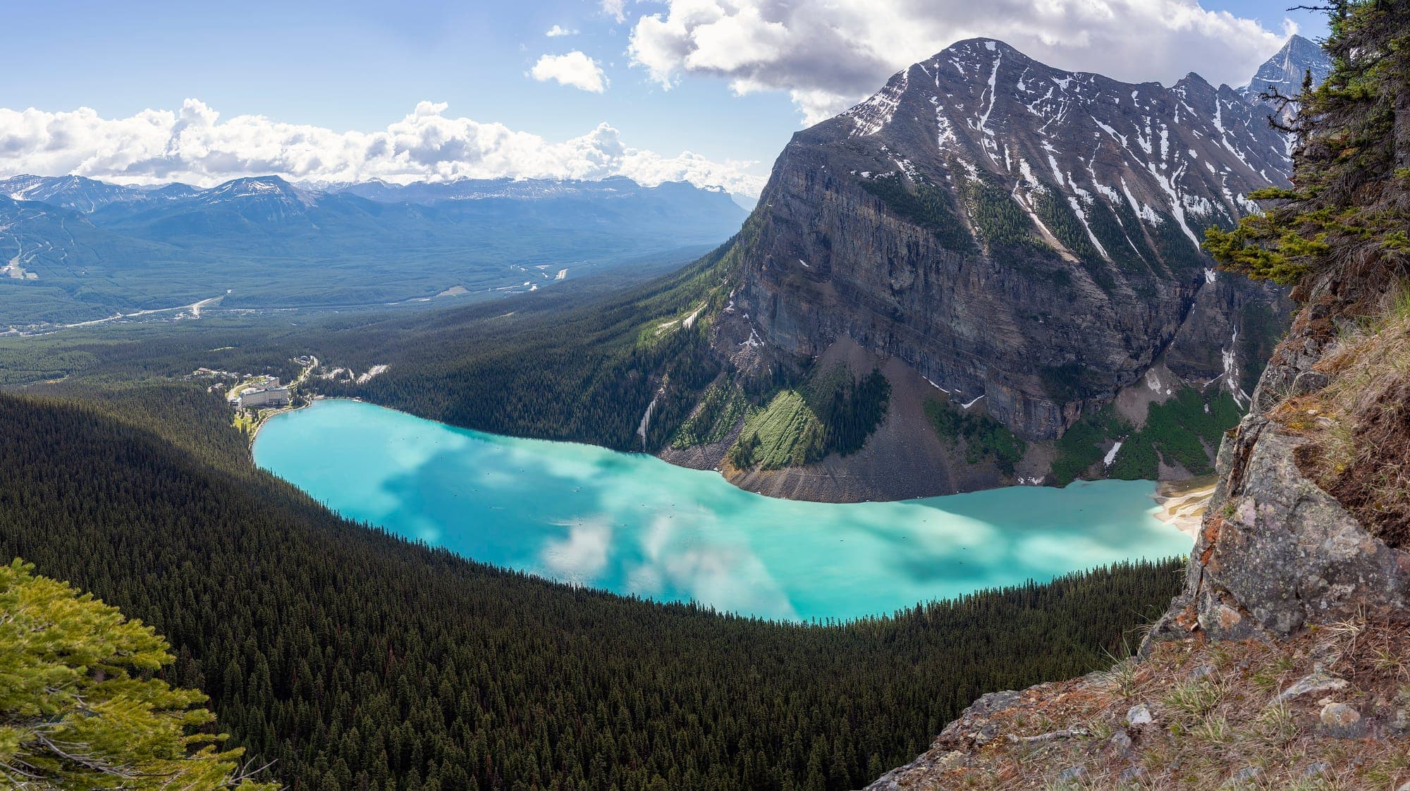

Peyto Lake or Lake Louise?
They are different visits, and if you have a car and a spare morning you do both. Lake Louise is a lake you stand beside, canoe on and walk around, with a hotel, a boathouse and two tea houses on its trails. Peyto Lake is a lake you look down on for fifteen minutes from a platform, and that view, from that height, is the reason it is on every Parkway list.
The practical difference is access. Lake Louise in summer means a lot that fills before sunrise or a shuttle reservation. Peyto Lake means a drive and a free car park with no gate. If your Lake Louise plans fell apart at eight in the morning, Peyto Lake is the day that still works. It does not replace Lake Louise; it rescues the day.
The colour question comes up every time. Both lakes are glacial and both turn turquoise with rock flour through the summer. Peyto Lake looks bluer because you see it from above, with the whole surface catching the sky. Stand on the Big Beehive above Lake Louise and the comparison evens out. The Lake Louise and Moraine Lake comparison settles the other version of this argument.
Peyto Lake in winter
You can reach Peyto Lake in winter, on winter tires, in daylight, and on snowshoes for the last stretch. Parks Canada lists it as a winter stop on the Parkway and keeps a winter parking area open, but the upper road is not ploughed, so the viewpoint becomes a 570 metre snowshoe loop from the lot.
| Snowshoe loop from the parking lot | 570 m, +30 m / −10 m |
|---|---|
| Upper road | unplowed |
| Day use area closure dates | not published |
| Avalanche closure at the viewpoint | none published |
| Snow tires or chains on the Parkway | 1 November to 31 March |
| Ploughing hours on the Parkway | 7 am to 3:30 pm, seven days a week |
| Services on the Parkway in winter | none between Lake Louise and Jasper |
Parks Canada's description of the winter route: “ From the parking lot there are two loops. Start by following either the unplowed upper road or take the official trail from the north end of the parking lot. From the viewpoint, a second loop runs through gladed forest.” No closure is published for the viewpoint, and Parks Canada lists it among the Lake Louise area snowshoe trails. The road is another matter: the Parkway has 38 marked avalanche paths, closes for control work after storms, and is cleared last. Read the road conditions page before you commit, and go inside the ploughing hours.
The lake itself is frozen and white for most of the winter, so the colour is gone. What you get instead is the platform to yourself, the Bow Summit meadows under snow, and a road with almost nobody on it. The winter page covers what the lake at Lake Louise is doing in the same months.
Common questions
How far is Peyto Lake from Lake Louise?
Can I drive to Peyto Lake?
Is Peyto Lake free?
How long is the walk to the Peyto Lake viewpoint?
Is Peyto Lake open in winter?
Is there a shuttle to Peyto Lake?
Distances, the viewpoint, the barrier-free trail and the park pass rule from Parks Canada's Icefields Parkway page; trail distances, climbs and times from the Banff hiking page; current trail status from the trail conditions report; the winter loop from the Lake Louise snowshoeing page; winter stops from the Parkway in winter page; the 45 km figure from the bird watching page; the rebuild dates from the closure bulletins of 2019 and 2021. Park pass fees from Parks Canada's fees page; Parkway rules from the Highway 93 page sources. Last checked September 15, 2026.