The Rockpile Trail at Moraine Lake
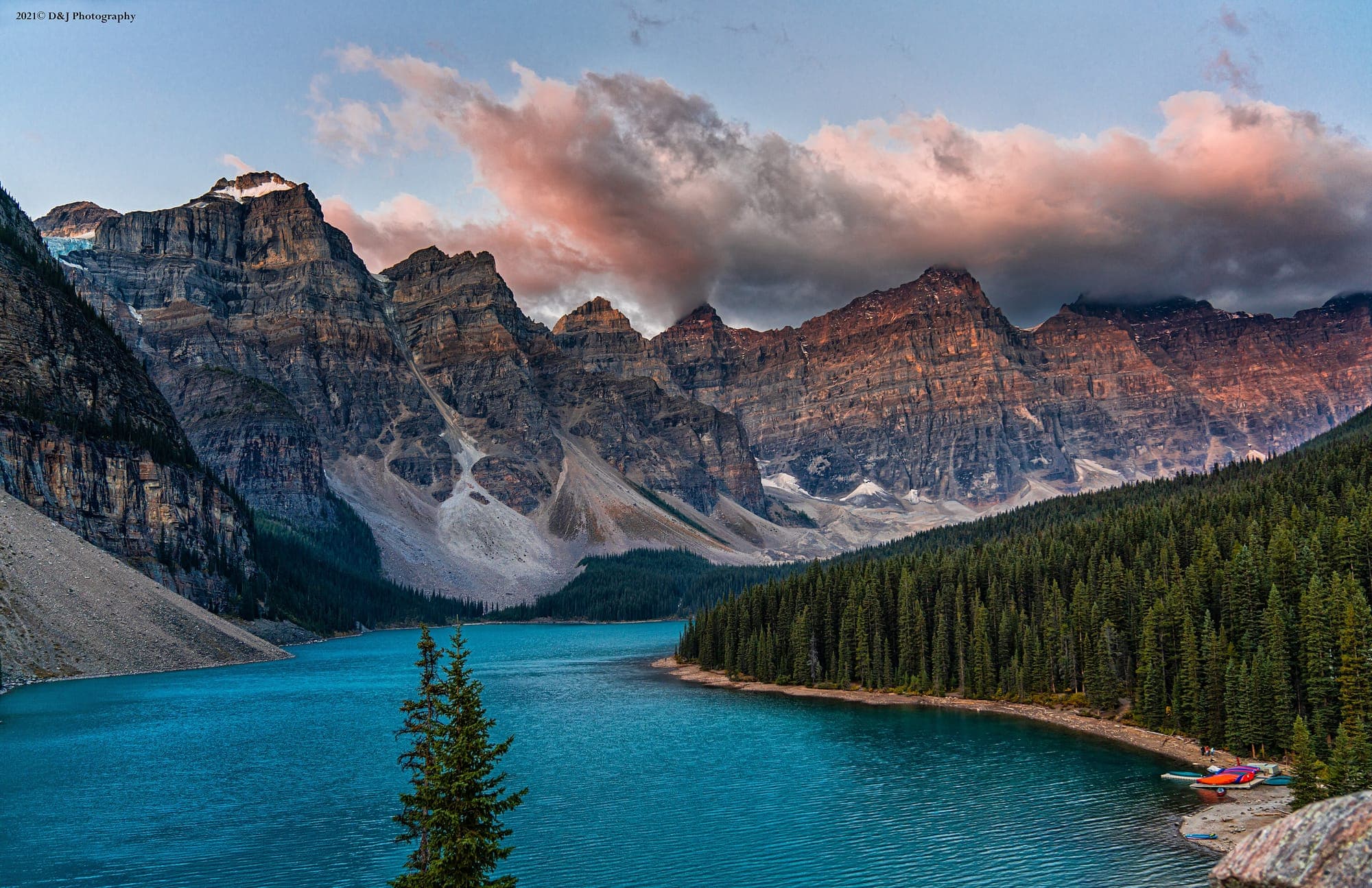
The shortest walk at Moraine Lake and the one the photograph comes from. A 0.7 kilometre loop up the boulder pile at the outlet, 35 metres of climbing, half an hour there and back.
Updated Mountain Time.
.jpg)
Getting to the trailhead without a car
Moraine Lake Road is closed to personal vehicles year-round. You arrive on the Parks Canada shuttle from the Lake Louise Park and Ride, on the Lake Connector from the Lake Louise lakeshore, with a licensed commercial operator, or by bicycle up the 14 kilometre road. The only exceptions are registered guests of Moraine Lake Lodge and holders of a government-issued accessible parking placard.
The shuttle to Moraine Lake runs 1 June to 12 October 2026, and every seat is booked in advance at reservation.pc.gc.ca. 40 percent of the season went on sale on 15 April 2026 and the other 60 percent is released at 8 am Mountain Time two days before travel. The last Lake Connector back to the lakeshore leaves Moraine Lake at 6:00 pm and the last bus to the Park and Ride at 7:30 pm.
The trail at a glance
The Rockpile is a 0.7 kilometre loop with 35 metres of climbing and 35 metres back down, and Parks Canada estimates 30 minutes for the round trip and rates it easy. You start on the Consolation Lakes trail beside the outlet stream and turn right at the first junction, then climb the pile of boulders on a built path with steps to the top.
Most people are on the top within ten minutes and spend the rest of the half hour there. It is a climb on steps, so it is not suitable for a pushchair or a wheelchair. Parks Canada asks you to stay on the path and not to climb on the rocks: the boulders beside it are loose and the drop on the lake side is real.
The view from the top, and the twenty-dollar bill
From the top you look down the full length of Moraine Lake to the Valley of the Ten Peaks, with the peaks in a row along the far side. Parks Canada calls it one of the most iconic Moraine Lake photo locations. The water is darkest at dawn and turns its full blue once the sun reaches the surface, usually by mid-morning.
The same view was on the back of a Canadian twenty-dollar note. The Bank of Canada Museum records that the $20 note of the Scenes of Canada series was first issued in June 1970, that its back shows Moraine Lake in the Valley of the Ten Peaks engraved from a photograph in the Canadian Pacific Railway collection, and that the note was reissued in 1979 with the serial numbers moved to the back. That is why people still call this the twenty-dollar view.

Sunrise on the Rockpile
Sunrise is the busiest half hour of the day on the Rockpile, and it needs its own booking. The regular shuttle does not start early enough, so Parks Canada runs the Alpine Start, which leaves the Lake Louise lakeshore parking lot, with paid parking, at 4:00 am and 5:00 am from 1 June to 12 October 2026. It sells out well ahead in summer and in larch season, and changes or cancellations close at 3:00 pm the day before. The Moraine Lake shuttle page has the booking steps.
Bring more clothing than the forecast suggests. The lake sits at 1884 metres, 153 metres above Lake Louise, and you stand still on the top for an hour waiting for the light. The peaks catch the sun long before the water does, and the lake does not turn colour until well after that, so a sunrise trip and a midday trip give two different photographs. If you want the blue water rather than lit peaks, book the midday shuttle instead.
Adding the lakeshore trail
The Moraine Lake lakeshore trail is 1.3 kilometres one way, flat, and Parks Canada estimates 45 minutes for the round trip. It begins just beyond Moraine Lake Lodge and follows the shore below the Ten Peaks to the far end of the lake, with the view of Mount Fay and the Fay Glacier opening as you go. Together with the Rockpile it makes a comfortable hour and a quarter.
Do the Rockpile first, while the queue for the top is shortest, then walk the shore. If you want more, the Consolation Lakes trail leaves from the junction below the Rockpile: 2.9 kilometres one way with 135 metres of climbing and two hours return, rated easy, across a boulder field to a lake under the Quadra Glacier. Larch Valley is the full hike and has its own page.
Safety and closures
Parks Canada advises avoiding high elevation trails from November to June because of avalanche risk.
Bear warnings, minimum group size requirements and closures are put in place through the season. Check the Parks Canada trail report on the day you walk.
Common questions
How long is the Rockpile trail?
Is the Rockpile hard?
Can I drive to the Rockpile?
Is the Rockpile open in winter?
Distance, elevation and time from the Parks Canada map of the Lake Louise area. Checked 2026-08-10.